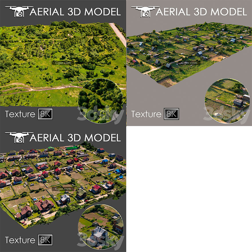
3組3dsky網(wǎng)站的航拍掃描的地形Pro模型合集。
使用直升機(jī)對(duì)地形進(jìn)行了3D掃描。適用于作為背景填充的總體規(guī)劃可視化。該模型是在真實(shí)照片的基礎(chǔ)上制作的,包含景觀的許多細(xì)節(jié)和特征。
我建議使用 Slice 修改器編輯模型,以便您可以將模型修剪到所需的區(qū)域。
僅用于長(zhǎng)期計(jì)劃作為預(yù)覽。
標(biāo)簽
空中掃描, 掃描, 外觀, 總體規(guī)劃, 城市, 房屋, 區(qū)域, 建造, 森林, 草坪, 道路

Aerial scan 8
Aerial scan 10
Aerial scan 16
A 3D scan of the terrain was made using a quadrocopter at an altitude of 60 m.
The model consists of one Edit Poli with 1 texture scan.
Texture (scan) 8192x8192
Suitable for visualization of master plans as a background fill. The model is made on the basis of real photos and contains many details and features of the landscape.
I recommend editing the model with the Slice modifier, so you can trim the model to the desired areas.
Use only for long-range plans as a preview.
tags
aerial scan, scan, exterior, general plan, city, houses, area, building, forest, lawn, road
描述:
標(biāo)簽: 室外 鳥瞰 地形 場(chǎng)景 航拍分類:資源 > 3D資源 > 3dsky/3ddd
發(fā)布:CGer | 查看: | 發(fā)表時(shí)間:2022/11/14 17:30:53 | 更新時(shí)間:2025/4/5 11:28:02
○ 因利息系統(tǒng)長(zhǎng)期被人利用漏洞刷取CG點(diǎn),目前取消利息功能,作為補(bǔ)償,每個(gè)已存在賬號(hào)額外一次性補(bǔ)償當(dāng)前余額的 30% ,后續(xù)充值贈(zèng)送百分比提高 100% (暫定),請(qǐng)知悉。 ○ 充值或賬號(hào)問題請(qǐng)【點(diǎn)擊這里聯(lián)系站長(zhǎng)】 |
—————————————————————————————————————————————— | ||
| 哪些資源會(huì)被列為付費(fèi)資源? ●站長(zhǎng)付費(fèi)購(gòu)買的資源,站長(zhǎng)從其他途徑付費(fèi)購(gòu)買的資源。 ●資源包體積巨大,需要大量時(shí)間上傳,占用大量存儲(chǔ)空間的資源。(目前超過10GB的資源可能會(huì)列為付費(fèi)資源) ●內(nèi)容經(jīng)常被某些人倒賣并惡意舉報(bào)的資源,收費(fèi)可以減少惡意舉報(bào)的概率。 ●稀少的和高質(zhì)量的資源。 |
| 常見問題,點(diǎn)擊查詢: | ||
| ●CGer(Cg兒)資源下載幫助 | ||
| ●資源名詞解釋 | ||
| ●注冊(cè)/登陸問題 | ||
| ●充值出錯(cuò)/修改密碼/忘記密碼 | ||
| ●充值贈(zèng)送系統(tǒng) | ||
| ●文件解壓出錯(cuò)/解壓密碼 | ||
| ●Payment with Paypal | ||
| ●哪些資源會(huì)被列為付費(fèi)資源 | ||
| ●為何要充值解鎖 | ||
| ●免責(zé)條款 | ||
| ●聯(lián)系站長(zhǎng)(聯(lián)系站長(zhǎng)前請(qǐng)先仔細(xì)閱讀 免責(zé)條款 ,網(wǎng)站只提供資源,不提供軟件安裝等服務(wù)!) | ||
-

網(wǎng)站置頂/公示帖集合
3 0 0
資源 > 3D資源 > 3dsky/3ddd
-

網(wǎng)站置頂/公示帖集合
3 0 0
資源 > 3D資源 > 3dsky/3ddd
-

網(wǎng)站置頂/公示帖集合
4 0 0
資源 > 3D資源 > 3dsky/3ddd


